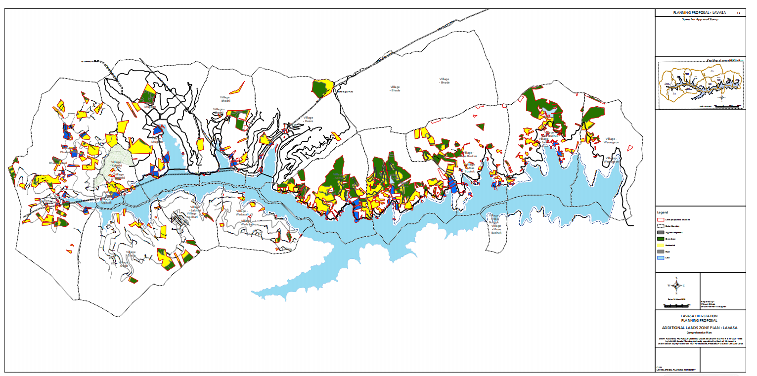
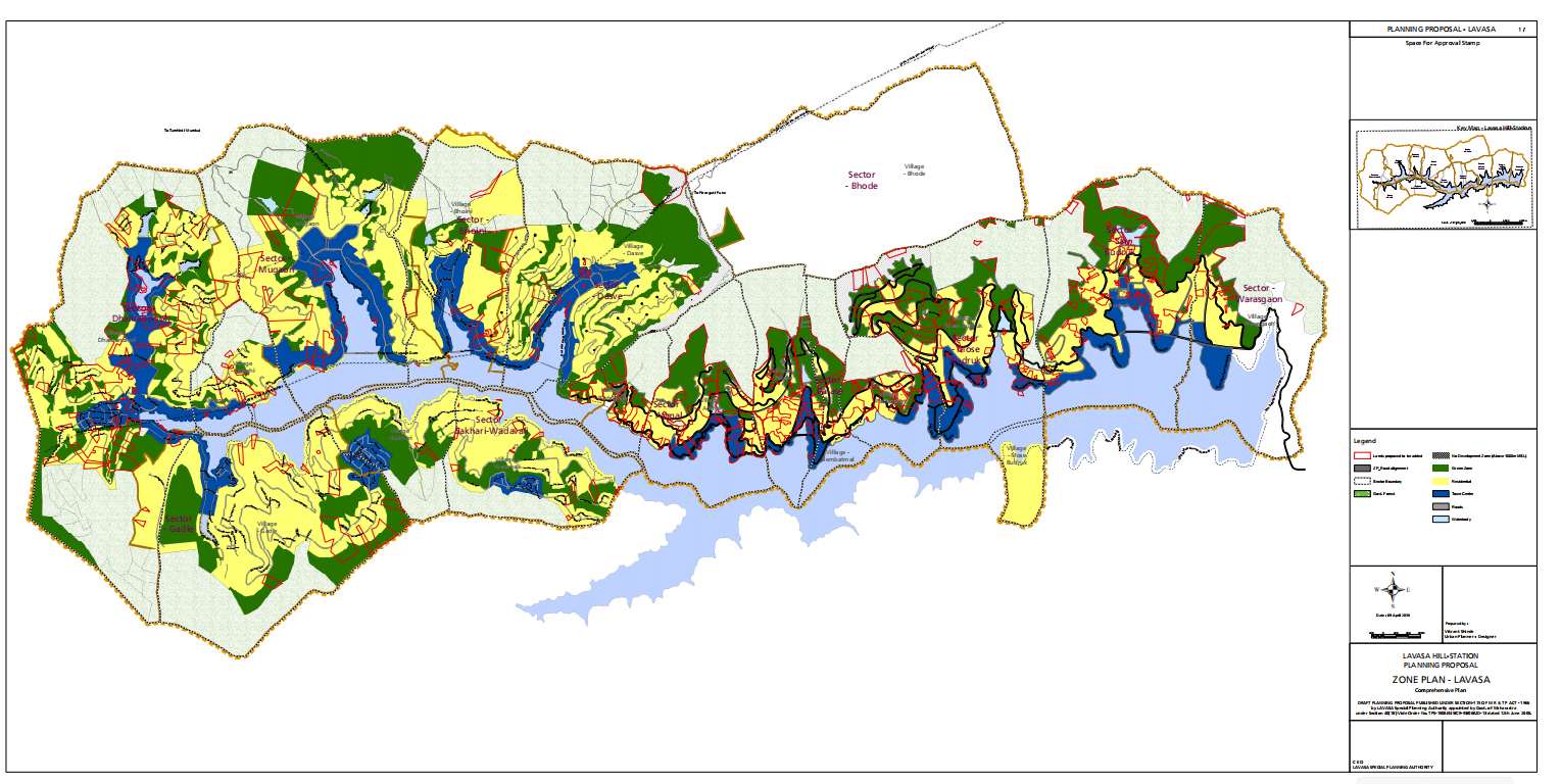
The 3000-acre development plan for Lavasa Corporation is guided by a sensitive and strategic response to the site’s unique topography and natural features. The planning approach prioritizes sustainable land use by identifying developable zones while preserving forests, water bodies, steep slopes, and ravines.
Development is concentrated on flatter, accessible areas, ensuring minimal environmental disruption. Natural features like lakes, valleys, and ridgelines are integrated into the master plan as landscape and recreational assets. Market feasibility drives a balanced mix of residential, commercial, institutional, and tourism-based zones—aligned with terrain and connectivity.
The result is a well-structured, context-driven plan that harmonizes built form with nature, ensuring long-term viability, resilience, and quality of life.
Pune Metro
The multi-modal integration plan for Pune Metro focuses on seamless connectivity, efficient movement, and user-centric design. Key metro stations are developed as transit hubs, integrating metro, bus, auto, and non-motorized transport with clear wayfinding and safe, accessible interfaces.
Land use around stations is optimized through transit-oriented development (TOD), encouraging compact, walkable, and mixed-use neighborhoods. Last-mile connectivity is strengthened with pedestrian zones, cycling infrastructure, and feeder services.
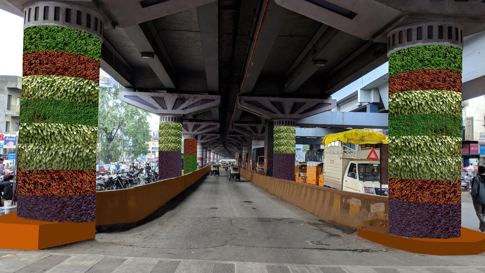
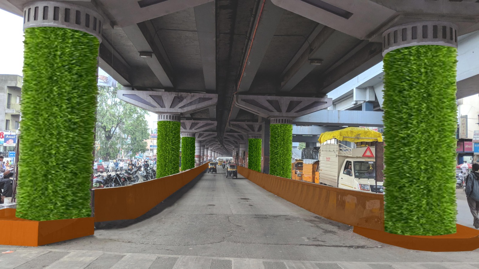
Hadapsar flyover beautification
Greening the columns under flyovers brings life to overlooked infrastructure through vertical landscaping and creative design. Using climbers, green wraps, or modular planters, the columns become visual anchors that reduce heat, dust, and noise while enhancing urban aesthetics.
Low-maintenance, drought-tolerant species are selected for sustainability, supported by drip irrigation systems. Integrated lighting and public art further activate the space, making it safer and more engaging. This approach turns hard infrastructure into green urban markers, contributing to a healthier, more vibrant streetscape.
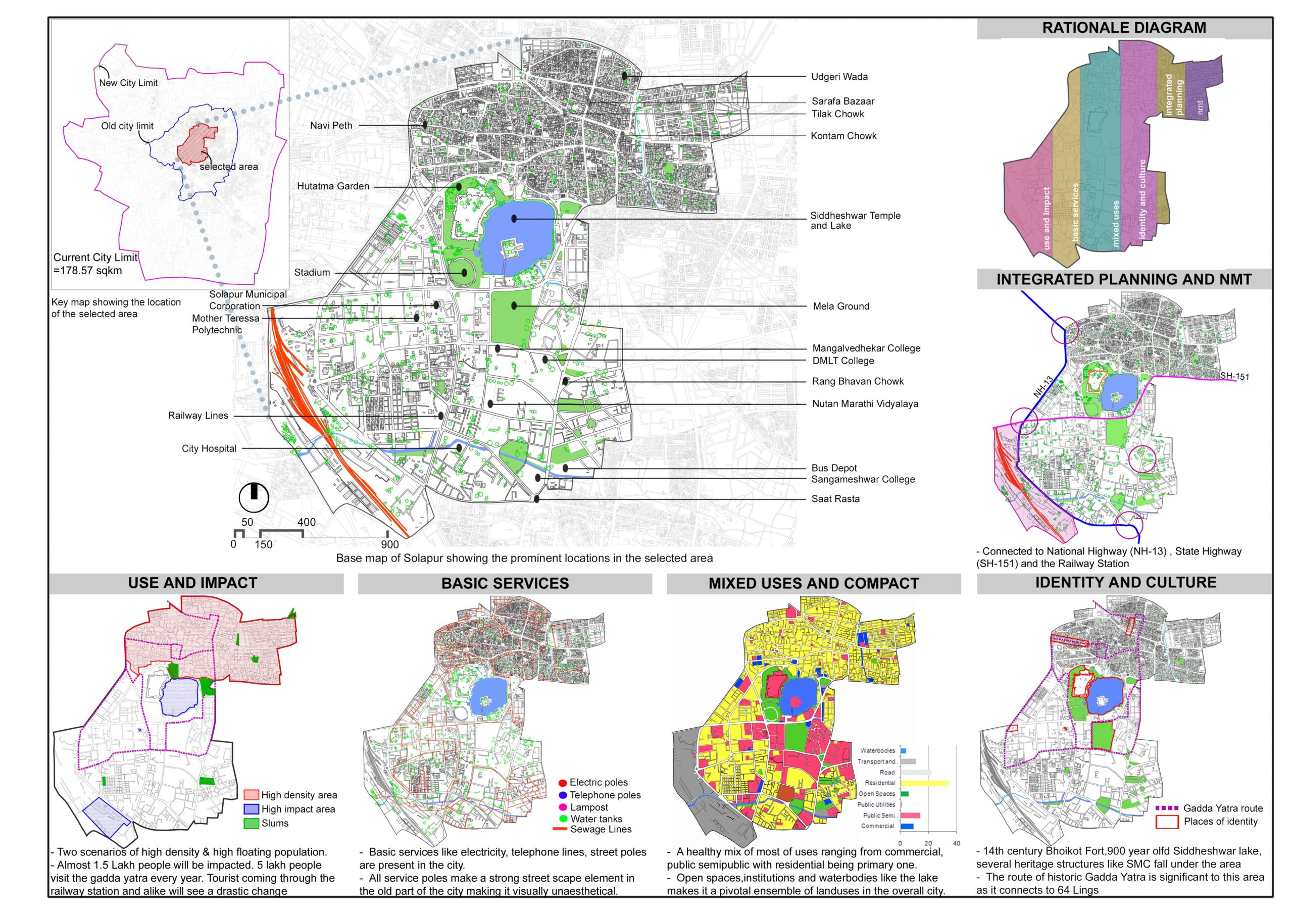
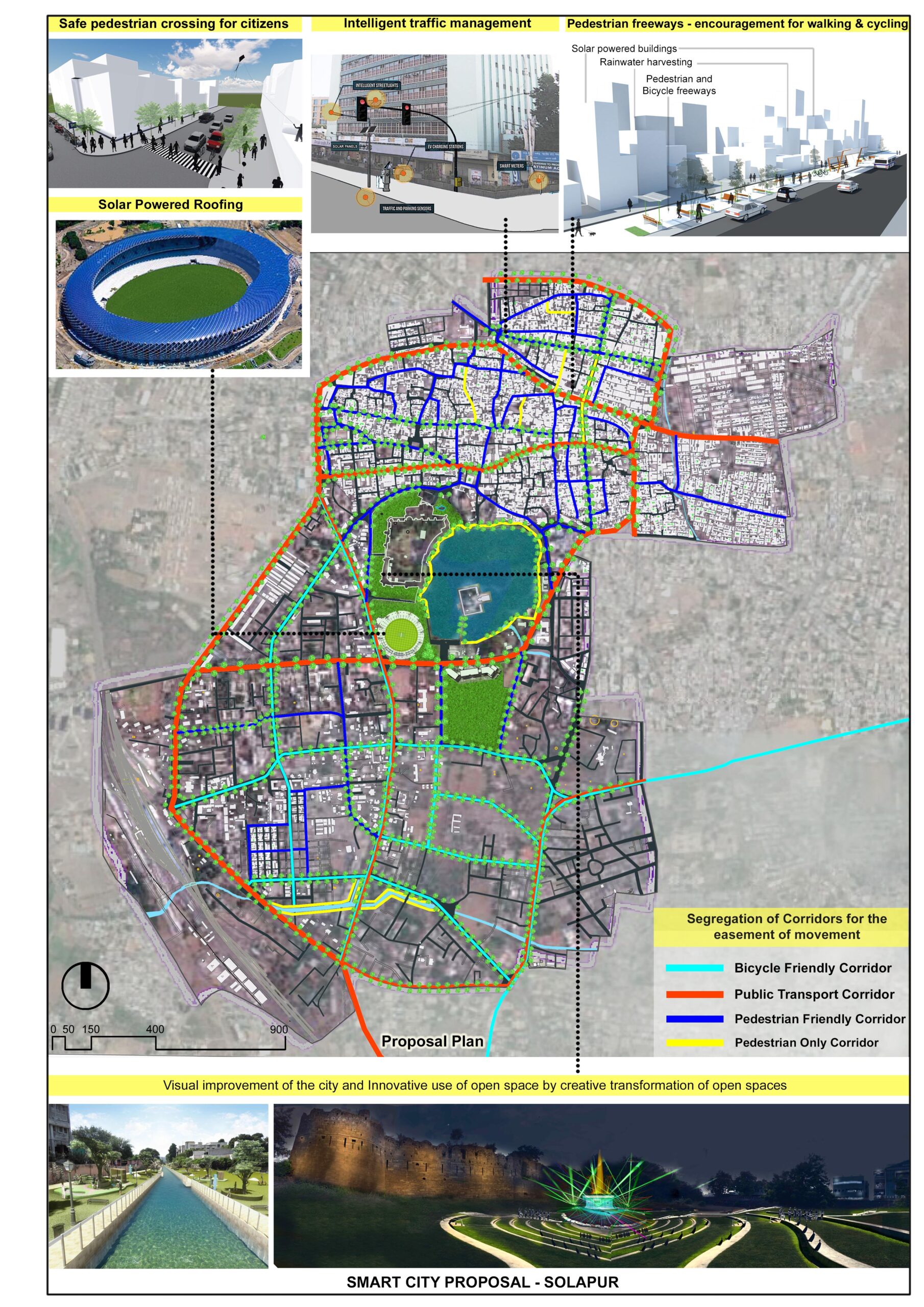
Solapur smart city proposal
The Solapur Smart City proposal adopts a holistic, data-driven planning and urban design strategy rooted in city studies, growth trends, and future needs. The approach leverages Solapur’s natural resources—integrating existing water bodies, green cover, and open spaces into a resilient urban framework.
A strong emphasis is placed on improving mobility through multimodal transportation, walkable streets, and transit-oriented development. Infrastructure upgrades are planned alongside smart solutions in water management, energy, and waste, ensuring sustainability and efficiency.
By blending heritage with innovation, the proposal creates inclusive, connected, and vibrant urban spaces. Ranked 9th among 100 proposals nationally, it reflects a forward-looking vision that balances environmental sensitivity with urban growth and livability.
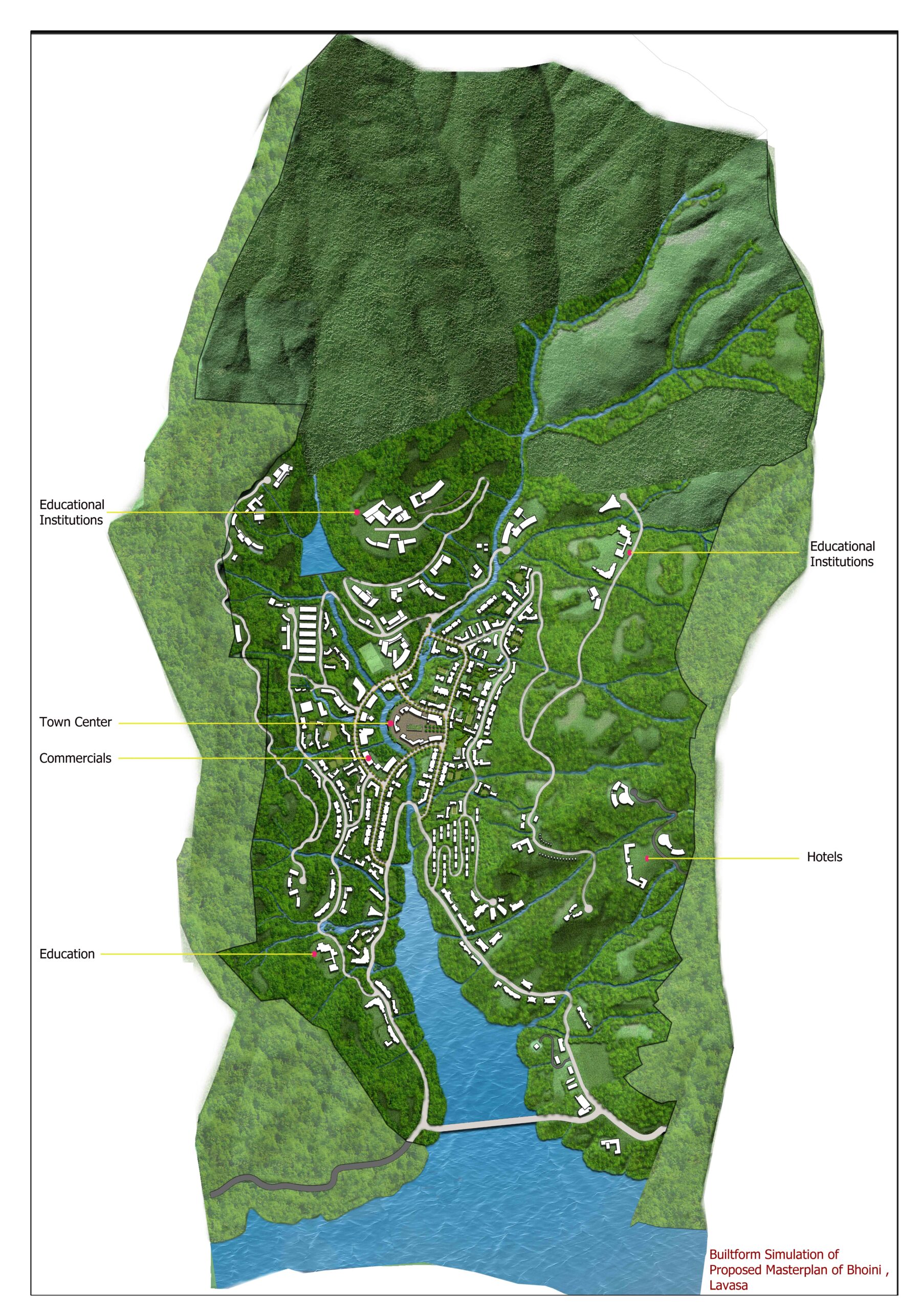
Bhoini masterplan
The 1000-acre development plan for Bhoini in Lavasa is shaped by a context-responsive strategy that respects the site’s natural topography, landforms, and ecological assets. The planning process begins with identifying developable land by carefully mapping out forested zones, steep gradients, water bodies, and ravines to ensure minimal ecological disruption.
Development is clustered in flatter, accessible zones to reduce infrastructure footprint and construction costs, while preserving natural drainage and views. Key land parcels are allocated for residential, hospitality, and institutional use, guided by market feasibility and phased demand. Forest edges, watercourses, and ridge lines are retained as green buffers and integrated into a network of open spaces and trails, enhancing liveability and ecological value.
This approach creates a sustainable, phased development framework that balances environmental stewardship with economic potential, offering a model for responsible hillside urbanism.
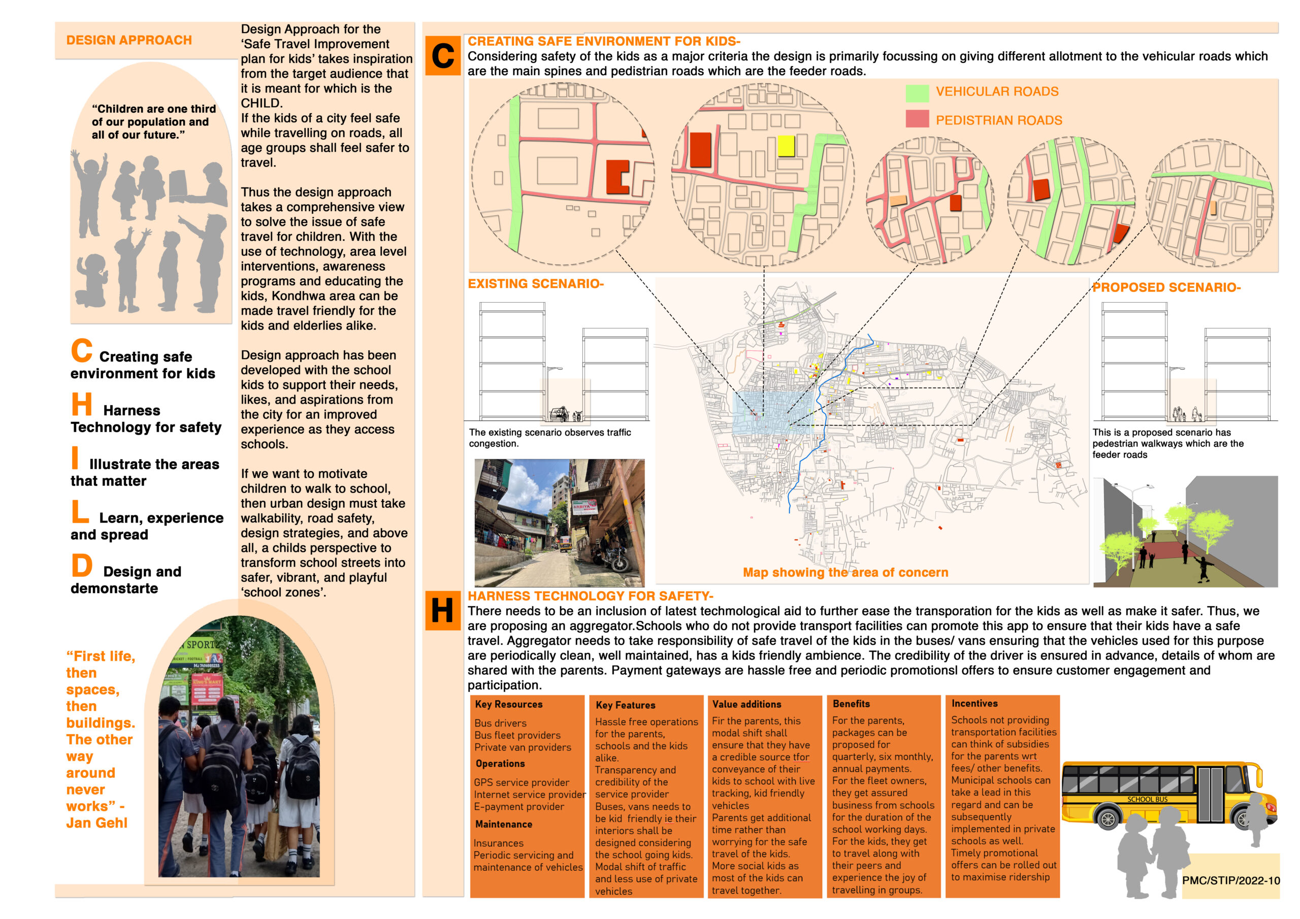
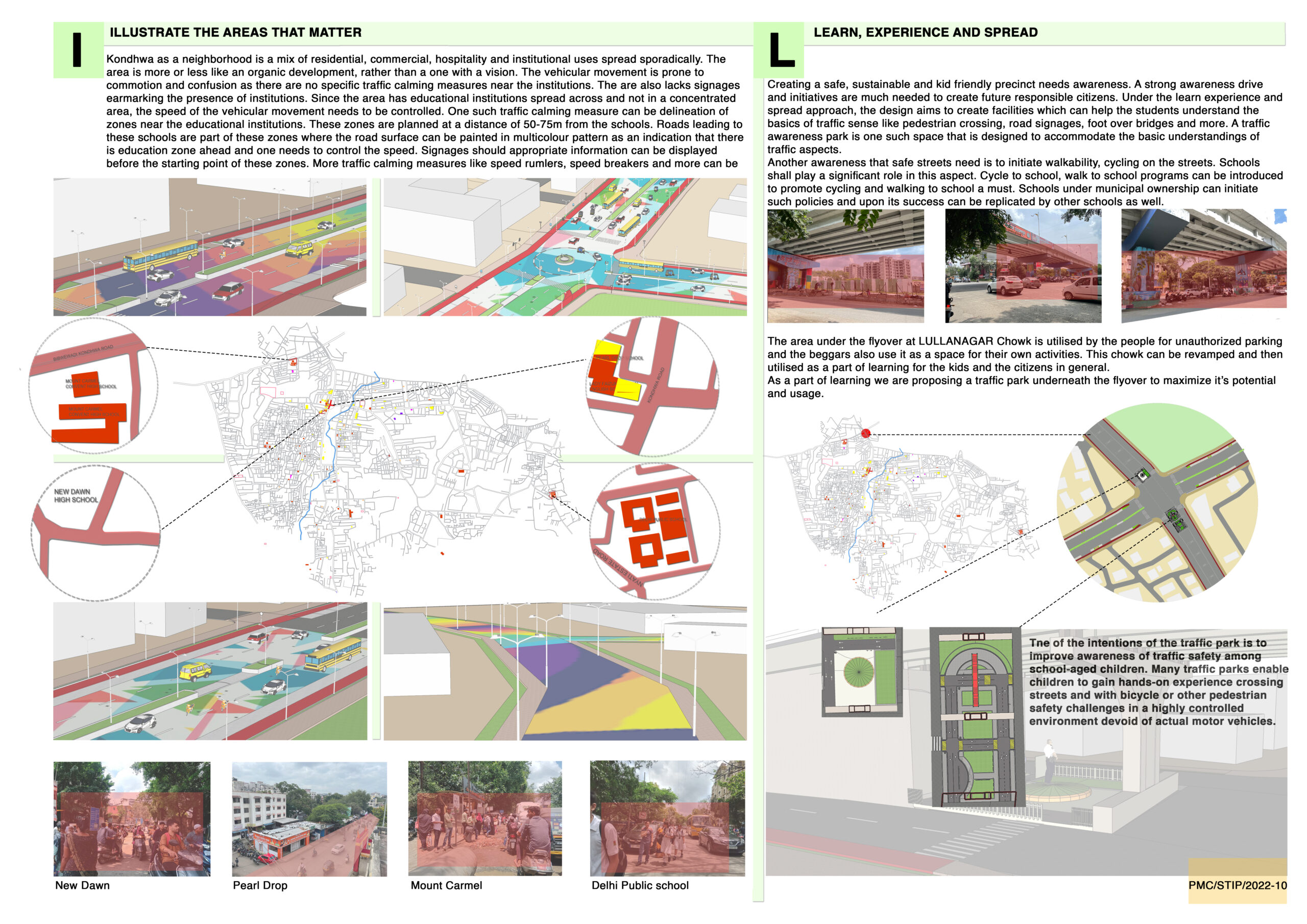
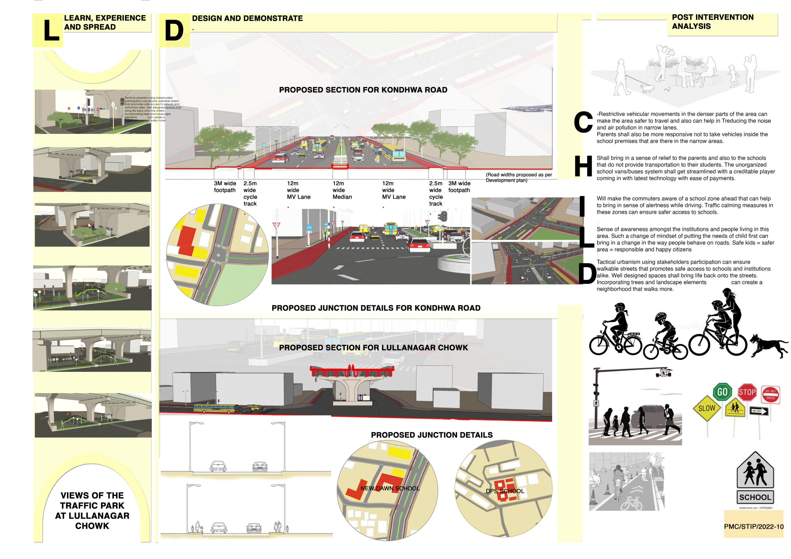
School travel improvement plan
The Safe School Travel Plan prioritizes child-friendly streets through a combination of smart technology and design interventions. Key measures include traffic calming features like raised crossings, narrowed lanes, signage, and dedicated drop-off zones to slow vehicles and enhance visibility.
Digital tools such as GPS tracking, smart signals, and school zone alerts improve monitoring and response. Safe walking and cycling routes are mapped and marked, with shaded paths, seating, and crossing guards to support independent, secure travel.
The approach fosters a safer, more inclusive urban environment—making school commutes predictable, accessible, and stress-free for children and parents alike.
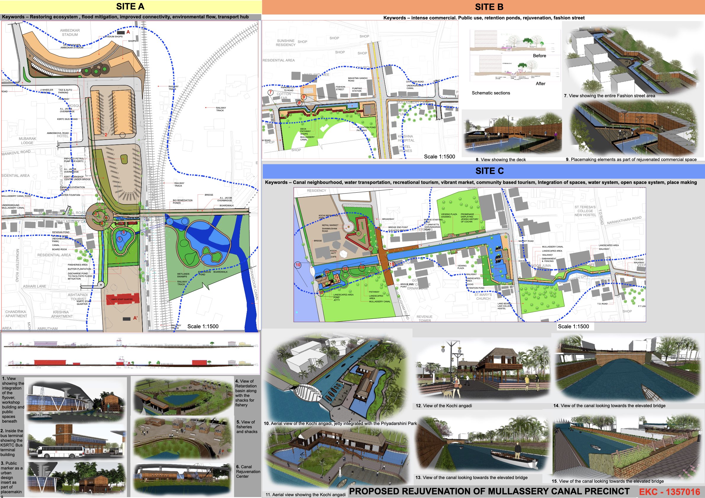
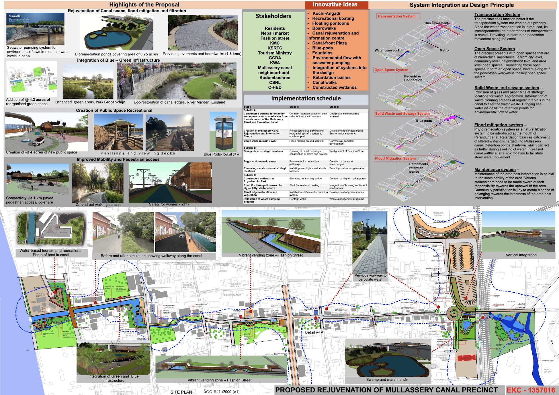
Mullasery canal design competition
The Mullasery Canal redevelopment proposal reclaims the canal as an ecological and social spine in the heart of Kerala. The approach focuses on restoring water flow, improving drainage, and integrating green buffers to enhance flood resilience.
Walkways, seating, and cultural nodes line the edges, transforming the canal into a vibrant public space. Native vegetation, bio-swales, and waste management systems promote environmental health, while celebrating the canal’s heritage.
This proposal blends ecology, infrastructure, and community to revive the canal as a clean, active, and inclusive urban asset.
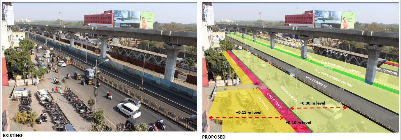
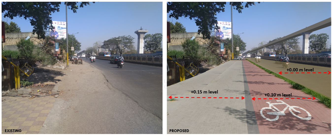
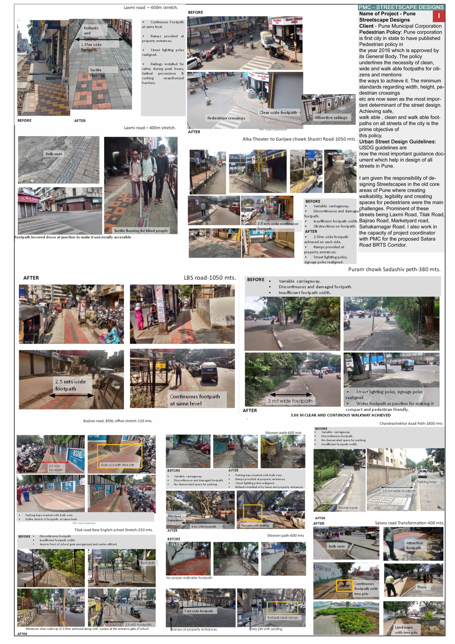
Pune Street Design Works
Our street design works in Pune focuses on creating safer, more inclusive, and pedestrian-friendly public spaces. Working closely with local authorities and stakeholders, we redesigned key urban stretches to improve walkability, streamline traffic flow, and enhance overall accessibility. The design integrates dedicated footpaths, cycle tracks, organized parking, green buffers, and universal access features—ensuring a balanced experience for pedestrians, cyclists, and vehicles. Role of trees was one of the key influencers for design considerations. Emphasis was placed on contextual design, sustainability, and ease of long-term maintenance, contributing to a more liveable and connected city.